Newcastle City Council
Tree preservation zone
There is a problem
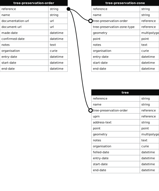
- 1000 entries with tree-preservation-order field must match the reference field in the tree preservation order dataset
High Gosforth Park
- reference
- 1995/017.W14
- name
- High Gosforth Park
- tree-preservation-order
- 1995/017
- tree-preservation-zone-type
- woodland
- geometry
- MULTIPOLYGON (((-1.620860 55.029127,-1.620323 55.029093,-1.620292 55.029088,-1.620264 55.029079,-1.620159 55.029031,-1.619900 55.029021,-1.619870 55.029012,-1.619826 55.028991,-1.619794 55.028972,-1.619613 55.028824,-1.619588 55.028802,-1.619562 55.028774,-1.619516 55.028694,-1.619510 55.028711,-1.619510 55.028740,-1.619507 55.028750,-1.619498 55.028770,-1.619484 55.028784,-1.619468 55.028793,-1.619429 55.028811,-1.619394 55.028821,-1.619369 55.028826,-1.619350 55.028827,-1.619332 55.028825,-1.619304 55.028818,-1.619259 55.028806,-1.619165 55.028774,-1.619122 55.028770,-1.619097 55.028772,-1.619067 55.028780,-1.619030 55.028798,-1.618987 55.028824,-1.618937 55.028865,-1.618910 55.028902,-1.618891 55.028952,-1.618886 55.029025,-1.618899 55.029106,-1.618941 55.029174,-1.619009 55.029241,-1.619093 55.029304,-1.619172 55.029352,-1.619279 55.029410,-1.619414 55.029467,-1.619587 55.029519,-1.619753 55.029558,-1.619894 55.029579,-1.620002 55.029589,-1.620077 55.029594,-1.620080 55.029594,-1.620081 55.029592,-1.620112 55.029595,-1.620215 55.029593,-1.620396 55.029581,-1.620475 55.029571,-1.620553 55.029555,-1.620632 55.029527,-1.620691 55.029492,-1.620736 55.029451,-1.620774 55.029405,-1.620813 55.029341,-1.620840 55.029283,-1.620854 55.029230,-1.620860 55.029127)))
- point
- POINT (-1.619816 55.029217)
- notes
- These data are update live via a feed to NCC's Tree Managament System, EzyTreev
- entry-date
- 2022-07-01
- start-date
- 1995-01-01
- end-date
How to fix this issue
Your data is missing a tree-preservation-order.
The tree preservation zone guidance explains how to fix the issue:
tree-preservation-order
The reference for the tree preservation order that covers this zone.
How to improve Newcastle City Council’s data
- Fix the errors indicated
- Use the check service to make sure the data meets the standard
- Publish the updated data on the endpoint URL